
With the application of GPS positioning, GPS navigation, GPS mobile phones and other products, GPS has gradually penetrated into various fields and corners of civilian use. What is GPS, what is the function, what is the principle of GPS, with so many problems. Xiaobian, by tidying up the information, simply tells everyone what GPS is, and hopes to help everyone.
This article refers to the address: http://
What is GPS?
GPS is the Global Positioning System. Simply put, this is a satellite system consisting of 24 satellites covering the globe. The Global Positioning System (GPS) is a new generation of space satellite navigation and positioning system jointly developed by the US Army, Navy and Air Force in the 1970s. This technology can be used to guide aircraft, ships, vehicles and individuals to safely and accurately follow a selected route and arrive at their destination on time.
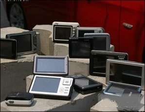
GPS navigation products
GPS global satellite positioning system
Space part - GPS constellation
Ground control part - ground monitoring system
User equipment part --- GPS signal receiver.
The predecessor of the GPS system was a meridian satellite positioning system (Transit) developed by the US military. It was developed in 1958 and officially put into use in 64 years. The system works with a star network of 5 to 6 satellites, bypassing the earth up to 13 times a day, and is unable to give height information, and is not satisfactory in terms of positioning accuracy. However, the Meridian system enabled the R&D department to gain initial experience in satellite positioning and verified the feasibility of positioning by satellite systems, paving the way for the development of GPS systems. Satellite positioning shows great advantages in navigation and also sees the huge flaws in the navigation system of submarines and ships. The US Army, Navy and Air Force and the civilian sector all feel the urgent need for a new satellite navigation system. After more than 20 years of research and experimentation, it cost 30 billion US dollars. By March 1994, 24 GPS satellite constellations with a global coverage rate of 98% had been completed. The satellite can collect the latitude and longitude and altitude of the observation point to realize functions such as navigation, positioning and timing.
What is GPS - GPS composition
1, the space part
The space part of the GPS is composed of 24 working satellites. It is located above 200 km from the surface of the earth, and is evenly distributed on 6 orbital planes (4 per orbital plane) with an orbital inclination of 55°. In addition, there are four active backup satellites in orbit. The distribution of satellites allows for the observation of more than four satellites anywhere in the world, at any time, and maintains a geometric image with good positioning accuracy. This provides continuous global navigation capabilities over time.
GPS satellite two sets of codes
C/ A code ( Coarse/ Acquisition Code11023MHz)
P code (Procise Code 10123MHz)
Due to the high frequency, the P code is not susceptible to interference and has high positioning accuracy. Therefore, it is controlled by the US military and has a password. It is generally unreadable by the public, mainly for the US military. The C/A code is mainly used for private use after taking measures to deliberately reduce the accuracy.
2. Ground control section
The ground control section consists of one master station, five global monitoring stations and three ground control stations. The stations are equipped with sophisticated cuckoo clocks and receivers capable of continuously measuring all visible satellites.
The satellite observation data to be obtained by the monitoring station, including the ionosphere and meteorological data, is transmitted to the main control station after preliminary processing. The master station collects tracking data from each monitoring station, calculates the satellite's orbit and clock parameters, and then sends the results to three ground control stations. The ground control station injects these navigation data and the command of the master station into the satellite when each satellite runs to the top. This injection is done once a day for each GPS satellite and for the final injection before the satellite leaves the range of the injection station. If a ground station fails, the navigation information pre-stored in the satellite can be used for a while, but the navigation accuracy will gradually decrease.
3. User equipment part
The user equipment part is the GPS signal receiver. Its main function is to be able to capture the satellites to be tested selected according to a certain satellite cut-off angle and to track the operation of these satellites. When the receiver captures the tracked satellite signal, it can measure the pseudo-distance and distance change rate of the receiving antenna to the satellite, and demodulate the satellite orbit parameters and other data.
According to these data, the microprocessor in the receiver can perform positioning calculation according to the positioning solution method, and calculate the latitude, longitude, altitude, speed, time and other information of the geographical location of the user. The receiver hardware and in-flight software, as well as post-processing software packages for GPS data, form a complete GPS user equipment. The structure of the GPS receiver is divided into two parts: an antenna unit and a receiving unit. The receiver generally uses two types of DC power sources, both internal and external. The purpose of setting the internal power supply is to not interrupt continuous observation when replacing the external power supply.
The battery is automatically charged when the power is off. After shutdown, the internal battery powers the RAM memory to prevent data loss. At present, various types of receivers are getting smaller and smaller, and the weight is getting lighter and lighter, which is convenient for field observation.
Key features of GPS Global Positioning System
(1) All weather
(2) Global coverage
(3) Three-dimensional fixed speed timing high precision
(4) Fast time saving and high efficiency
(5) Wide application and multi-function
What is GPS - the main purpose
(1) Terrestrial applications, including vehicle navigation, emergency response, atmospheric physical observation, geophysical resource exploration, engineering survey, deformation monitoring, crustal motion monitoring, municipal planning control, etc.;
(2) Marine applications, including the determination of the best voyage route of ocean-going vessels, real-time ship scheduling and navigation, marine rescue, marine exploration, hydrogeological measurement, and positioning of offshore platforms, sea level rise and fall monitoring;
(3) Aerospace applications, including aircraft navigation, aerial remote sensing attitude control, low-orbit satellite orbit determination, missile guidance, aviation rescue, and manned spacecraft protection detection.
User equipment part and GPS receiver. The main function is to capture some information of the satellite to calculate the latitude, longitude, altitude, speed time, etc. of the user's pile at the location*. The receiver consists of an accepting unit and an antenna unit, while the user equipment consists of the receiver hardware and in-machine software (maps...).

GPS receiver receiving signal source
GPS satellite receiver type
(1) According to the model, it is divided into geodetic type, full station type, timing type, handheld type, integrated type.
(2) According to the application, it is divided into vehicle-mounted, ship-borne, airborne, satellite-borne, and elastic-loaded
The GPS receiver module is a serial port output. The receiver on the market is provided by USB interface, PS2 interface and RS232 interface. You can select your own device according to your needs.
GPS receiver example analysis
The information received by the GPS receiver can be read through the serial port. The following is a set of data. From this information we can get information about our approximate location and accurate time. Below is the specific format of these data.
$PSRFTXT, Version:GSW3.2.4_3.1.00.12-SDK003P1.00a
$PSRFTXT, Version2: F-GPS-03-0701231
$PSRFTXT, WAAS Disable
$PSRFTXT, TOW: 105921
$PSRFTXT, WK: 1538
$PSRFTXT, POS: -2170399 4386065 4076920
$PSRFTXT, CLK: 95585
$PSRFTXT, CHNL: 12
$PSRFTXT, Baud rate: 4800
$GPGGA, 052613.172, 3959.1983, N, 11619.6639, E, 0, 03,, 74.0, M, -6.5, M,, 0000*5B
$GPGSA,A,1,30,14,29,,,,,,,,,,,,,*13
$GPRMC, 052613.172, A, 3959.1983, N, 11619.6639, E,,, 290609,, *01
$GPGGA, 052*.266, 3959.2084, N, 11619.6691, E, 1, 03, 4.1, 74.0, M, -6.5, M,, 0000*7F
$GPGSA,A,2,30,14,29,,,,,,,,,,,4.2,4.1,1.0*3C
$GPRMC, 052*.266, A, 3959.2084, N, 11619.6691, E, 1.24, 10.61, 290609,, *3E
$GPGGA, 052615.269, 3959.2074, N, 11619.6690, E, 1, 03, 4.1, 74.0, M, -6.5, M,, 0000*7F
$GPGSA,A,2,30,14,29,,,,,,,,,,,4.2,4.1,1.0*3C
$GPRMC, 052615.269, A, 3959.2074, N, 11619.6690, E, 2.09, 90.96, 290609,, *32
$GPGGA, 052616.269, 3959.2080, N, 11619.6676, E, 1, 04, 3.9, 48.4, M, -6.5, M,, 0000*7C
$GPGSA,A,3,30,14,29,12,,,,,,,,,,4.0,3.9,1.0*33
$GPRMC, 052616.269, A, 3959.2080, N, 11619.6676, E, 0.39, 281.94, 290609,, *03
$GPGGA, 052617.266, 3959.2117, N, 11619.*0, E, 1, 04, 6.9, 70.3, M, -6.5, M,, 0000*7E
$GPGSA, A, 3, 30, 14, 29, 12,,,,,,,,,, 8.3, 6.9, 4.5*39
$GPGSV,3,1,10,14,56,115,34,30,37,049,41,29,23,103,34,12,08,041,30*73
$GPGSV,3,2,10,16,75,122,,21,51,183,,31,50,055,,20,23,309,*7E
$GPGSV,3,3,10,22,21,297,,18,03,169,*73
$GPRMC,052617.266,A,3959.2117,N,11619.*0,E,0.10,299.68,290609,,*09
$GPGGA, 052618.000, 3959.2142, N, 11619.7011, E, 1, 04, 6.9, 80.7, M, -6.5, M,, 0000*74
$GPGSA, A, 3, 30, 14, 29, 12,,,,,,,,,, 8.3, 6.9, 4.5*39
$GPRMC, 052618.000, A, 3959.2142, N, 11619.7011, E, 0.16, 318.14, 290609,, *0D
$GPGGA, 052619.000, 3959.2174, N, 11619.7146, E, 1, 04, 6.9, 90.3, M, -6.5, M,, 0000*76
$GPGSA, A, 3, 30, 14, 29, 12,,,,,,,,,, 8.3, 6.9, 4.5*39
$GPRMC, 052619.000, A, 3959.2174, N, 11619.7146, E, 0.42, 64.37, 290609,, *32
$GPGGA, 052620.000, 3959.2194, N, 11619.7277, E, 1, 04, 6.9, 96.9, M, -6.5, M,, 0000*7F
$GPGSA, A, 3, 30, 14, 29, 12,,,,,,,,,, 8.3, 6.9, 4.5*39
$GPRMC, 052620.000, A, 3959.2194, N, 11619.7277, E, 1.04, 76.65, 290609,, *30
$GPGGA,052621.000,3959.2216,N,11619.7391,E,1,04,6.9,104.4,M,-6.5,M,,0000*49
$GPGSA, A, 3, 30, 14, 29, 12,,,,,,,,,, 8.3, 6.9, 4.5*39
$GPRMC, 052621.000, A, 3959.2216, N, 11619.7391, E, 0.97, 72.92, 290609,, *36
$GPGGA, 052622.000, 3959.2227, N, 11619.7426, E, 1, 04, 6.9, 107.2, M, -6.5, M,, 0000*46
$GPGSA, A, 3, 30, 14, 29, 12,,,,,,,,,, 8.3, 6.9, 4.5*39
$GPGSV,3,1,10,14,56,115,35,30,37,049,40,29,23,103,33,12,08,041,30*74
$GPGSV,3,2,10,16,75,122,,21,51,183,,31,50,055,,20,23,309,*7E
$GPGSV,3,3,10,22,21,297,,18,03,169,*73
Description: The NMEA0183 format starts with “$â€. The main statements are GPGGA, GPVTG, GPRMC, etc.
1. GPS DOP and Active Satellites (GSA) current satellite information
$GPGSA,<1>,<2>,<3>,<3>,,,,,<3>,<3>,<3>,<4>,<5>,<6>,<7>
<1> mode: M = manual, A = automatic.
<2> Positioning pattern 1 = not positioned, 2 = 2D positioning, 3 = 3D positioning.
<3>PRN number: 01 to 32 The satellite number in use in the sky, which can receive up to 12 satellite information.
<4> PDOP position accuracy factor (0.5~99.9)
<5> HDOP horizontal accuracy factor (0.5~99.9)
<6> VDOP vertical accuracy factor (0.5~99.9)
<7> Checksum. (check bit).
2, GPS Satellites in View (GSV) visible satellite information
$GPGSV, <1>, <2>, <3>, <4>, <5>, <6>, <7>, ?<4>, <5>, <6>, <7>, <8 >
<1> Total number of GSV statements
<2> The number of the GSV in this sentence
<3> The total number of visible satellites, 00 to 12.
<4> Satellite number, 01 to 32.
<5> Satellite elevation angle, 00 to 90 degrees.
<6> Satellite azimuth, 000 to 359 degrees. Actual value.
<7> Signal-to-noise ratio (C/No), 00 to 99 dB; no signal is received by the meter.
<8>Checksum. (check bit).
Individual satellites <4>, <5>, <6>, <7> will be repeated, with a maximum of four satellites per line. The remaining satellite information will appear on the next line, and if not used, these fields will be blank.
3, Global Positioning System Fix Data (GGA) GPS positioning information
$GPGGA,<1>,<2>,<3>,<4>,<5>,<6>,<7>,<8>,<9>,M,<10>,M,<11> , <12>*hh
<1> UTC time, hhmmss (hours, minutes and seconds) format
<2> Latitude ddmm.mmmm (degrees) format (the previous 0 will also be transmitted)
<3> Latitude hemisphere N (Northern Hemisphere) or S (Southern Hemisphere)
<4> Longitude dddmm.mmmm (degrees) format (the previous 0 will also be transmitted)
<5> Longitude hemisphere E (East) or W (Western)
<6> GPS status: 0=unlocated, 1=non-differential positioning, 2=differential positioning, 6=estimating
<7> The number of satellites (00~12) that are using the solution location (the previous 0 will also be transmitted)
<8> HDOP horizontal accuracy factor (0.5~99.9)
<9> Altitude (-9999.9~99999.9)
<10> Height of the Earth's ellipsoid relative to the geoid
<11> Differential time (the number of seconds since the last differential signal was received, if not differential positioning will be empty)
<12> Differential station ID number 0000~1023 (the previous 0 will also be transmitted, if not differential positioning will be empty)
4, Recommended Minimum Specific GPS / TRANSIT Data (RMC) recommended positioning information
$GPRMC, <1>, <2>, <3>, <4>, <5>, <6>, <7>, <8>, <9>, <10>, <11>, <12> *hh
<1> UTC time, hhmmss (hours, minutes and seconds) format
<2> Positioning status, A=effective positioning, V=invalid positioning
<3> Latitude ddmm.mmmm (degrees) format (the previous 0 will also be transmitted)
<4> Latitude hemisphere N (Northern Hemisphere) or S (Southern Hemisphere)
<5> Longitude dddmm.mmmm (degrees) format (the previous 0 will also be transmitted)
<6> Longitude hemisphere E (East) or W (Western)
<7> Ground rate (000.0~999.9, the previous 0 will also be transmitted)
<8> Ground heading (000.0~359.9 degrees, with the true north as the reference, the front 0 will also be transmitted)
<9> UTC date, ddmmyy (day, month, year) format
<10> Magnetic declination (000.0~180.0 degrees, the front 0 will also be transmitted)
<11> Magnetic declination direction, E (east) or W (west)
<12> Mode indication (only NMEA0183 3.00 version output, A= autonomous positioning, D=differential, E=estimate, N=invalid data)
5, Track Made Good and Ground Speed ​​(VTG) ground speed information
$GPVTG, <1>, T, <2>, M, <3>, N, <4>, K, <5> *hh
<1> Ground heading with true north as reference (000~359 degrees, the front 0 will also be transmitted)
<2> Ground heading with reference to magnetic north (000~359 degrees, the front 0 will also be transmitted)
<3> Ground speed (000.0~999.9, the previous 0 will also be transmitted)
<4> Ground speed (0000.0~1851.8 km/h, the previous 0 will also be transmitted)
<5> Mode indication (only NMEA0183 3.00 version output, A= autonomous positioning, D=differential, E=estimate, N=invalid data)
GPS main application - positioning and navigation for moving objects such as ships, cars, airplanes, etc.
(1) Ocean navigation and inbound water diversion
(2) Aircraft route guidance and approach landing
(3) Auto navigation
(4) Ground vehicle tracking and urban intelligent traffic management
(5) Emergency rescue
(6) Personal travel and wilderness adventure
After more than 20 years of practice, the GPS system is a high-precision, all-weather and global multi-function system for radio navigation, positioning and timing. GPS technology has developed into an international high-tech industry with multi-domain, multi-mode, multi-purpose and multi-model.
Product categories of Lithium Battery Charger, we are specialized in manufacturers from China,Lithium Battery Charger Supplier suppliers/factory, wholesale high-quality products of manufacturing, we have the perfect after-sales service and technical support. Look forward to your cooperation!
Lithium Battery Charger
Lithium Battery Charger,Bike Lithium Battery Charger,Bicycle Lithium Battery Charger,Lithium Motorcycle Battery Charger
Changxing Deli Technology Co., Ltd. , https://www.delipowers.com